England’s non-woodland trees freely mapped for first time
England’s trees outside woodlands have been mapped by satellite and laser are freely available for first time revealing they make up 30% of nation’s tree cover.
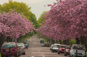
Street Trees. Credit: Forestry Commission
- Some of the most iconic trees in our landscape highlighted in unique survey.
- Mapping will help to accurately identify locations of nature depletion and allow for more targeted tree planting
England’s non-woodland trees have been mapped for first time, revealing these trees make up nearly third of our nation’s tree cover.
Using one of the very latest methods of laser detection and satellite imagery,��the country’s top tree scientists at the UK Government’s Forest Research agency built a comprehensive picture of non-woodland trees across England.
The innovative map goes live today (Saturday 5 April).
By providing a better national picture, the groundbreaking map will allow conservation groups and local authorities to target tree planting efforts more accurately. The map can pinpoint lone trees that could be connected to nearby wooded areas to create better habitat for wildlife in support of the Government’s manifesto commitment to expand nature-rich habitats and help achieve our legal target to increase England’s woodland canopy to 16.5%.
Forestry Minister Mary Creagh said:
Our precious street trees improve air quality, mark the changing seasons and provide us with peace, shade and joy. Their value simply cannot be overstated.
“This groundbreaking new tree census will not only help us better understand our current tree canopy cover, but allow us to identify areas where we can create more nature rich habitats for wildlife and people to enjoy as part of our Plan for Change”
Sir William Worsley, Chair of Forestry Commission said:
“This has been a real endeavour by the team - the results are spectacular and will be invaluable to us as we strive to meet our legal target to increase tree planting cover.
“The map fills critical data gaps about our national tree assets, helping us understand this natural resource and the benefits it brings, including carbon storage. Many people - from citizens to governments – will use the map to make evidence-based decisions to improve management and protection of our trees.”
Freddie Hunter, Head of Remote Sensing at Forest Research,��said:
Freddie Hunter, Head of Remote Sensing at Forest Research,��said:
“This is an exciting moment. By using a combination of aerial and satellite technology,��we have been able to locate and measure all trees outside of woodland (TOW) for the first time. By combining the National Forest Inventory woodland map and the TOW map we have a complete picture of tree canopy in England.
“We used laser technology mounted on planes and images of the Earth’s surface captured by satellites to identify tree canopy cover across the breadth of the country. This will be vital in informing future tree-planting and monitoring.”
Trees outside woodlands are defined as single trees in urban and rural areas and are some of the most iconic trees in our landscape, ranging from sprawling tree-lined hedgerows to the much-loved trees on our streets and in our parks. These trees play an important role in storing carbon, regulating temperatures, and mitigating against the impacts of climate change, such as flooding and over-heating of our towns and cities. They also have a huge role in improving health and wellbeing - not least by reducing the impacts of air pollution.
The project is funded by Defra’s Natural Capital and Ecosystem Assessment (NCEA) programme. The government is committed to turbocharging nature’s recovery and the launch of the new map is the latest step to improve nature and tree-planting across our communities as part of the Plan for Change. This follows recent announcements on ,�� to boost forestry and sustainable housebuilding , and the establishment of a dedicated . The government has also recently announced up to £400 million for trees and peat, as part of the Nature for Climate Fund.
The map is fully automated thanks to its use of spatial datasets and can be updated regularly to capture changes in tree canopy cover. For more information, visit . The map can be viewed online on the , and is free to download from the Forestry Commission open data download website .
Additional Information:
- Forest Research is Great Britain’s principal organisation for forestry and tree-related research and is internationally renowned for the provision of evidence and scientific services in support of sustainable forestry.
- The map is derived from LIDAR data from 2016 to 2022 and satellite data from 2021 to 2024. It is therefore not fully representative of trees in 2025.
- The map is based on remote sensing, data analysis and algorithmic prediction combined with expert calibration, meaning an algorithm has predicted which of the features on the input data were trees. The feature detection accuracy of trees outside woodlands is 95%.
- The data set was derived from the Vegetation Object Model (VOM) LIDAR Vegetation Object Model (VOM), The National Lidar Survey (National LIDAR Programme - data.gov.uk), and Sentinel-2 (Sentinel-2 - Sentinel Online) imagery using spatial algorithms.
- The map will also be available via open web services from